(see photo gallery here below)
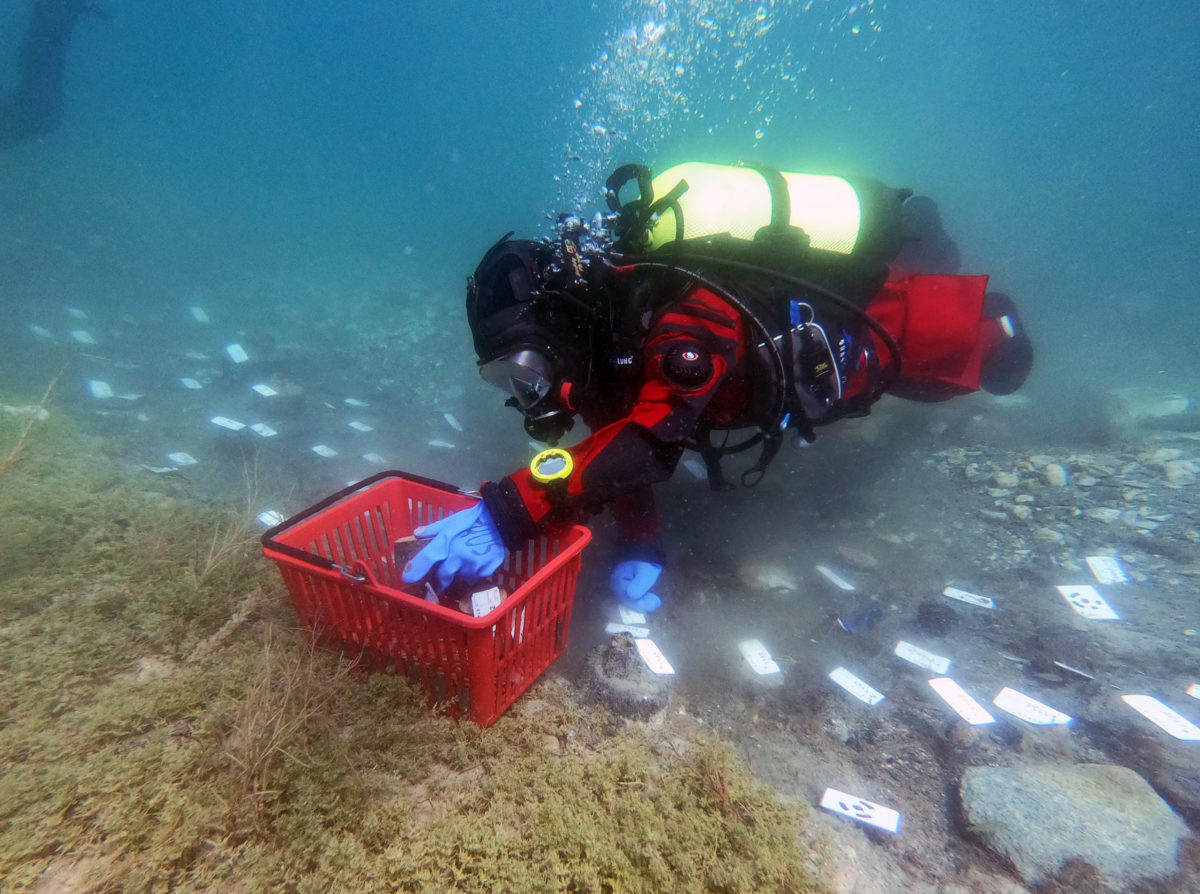
(Fig. 1) One of the most important data sets for the EXPLO project is the sampling of prehistoric wood to conduct dendrochronological analysis. Dendrochronological sampling requires cutting a well-preserved slice from each pile. Eroded parts of the piles are removed, thus changing the preserved situation on the site. Beforehand documentation must ensure that every pile is distinctly labeled and its location is accurately captured. While on land, this can easily be achieved, underwater working conditions complicate common procedures, e.g. mapping each pile with a theodolite and prism pole will get difficult and inefficient with increasing water depth.
Instead, we developed a new workflow for Structure from Motion (SfM) based underwater documentation. Our approach is time-saving, accurate, yet inexpensive. SfM is already widely used in underwater archaeology for the documentation of shipwrecks and other structures. The workflow was initially developed and successfully applied for the 2018 pilot-study and therefore pursued in 2019.
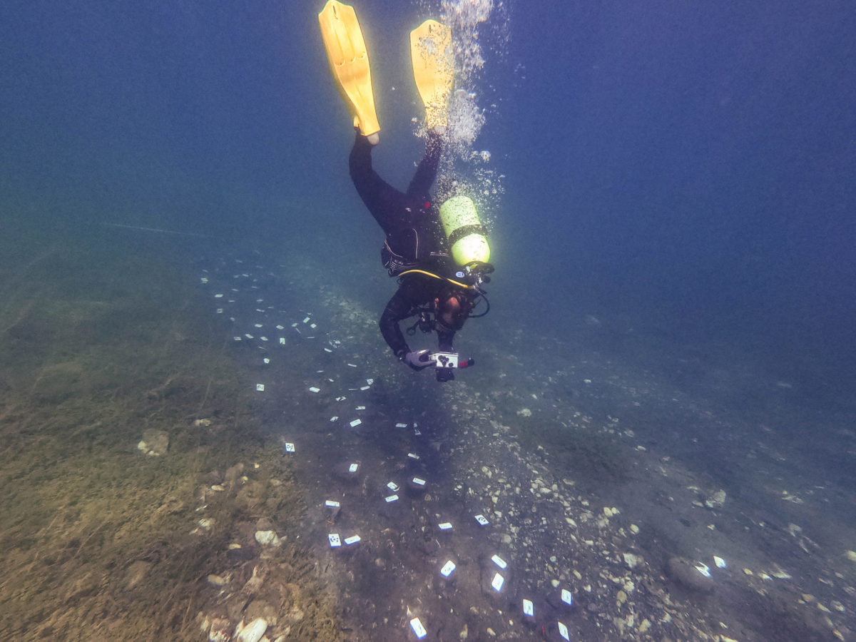
(Fig. 2) In those two campaigns, we were able to document and sample 90 square meters of the pile-field of Ploča Mičov Grad (Lake Ohrid, North Macedonia) with a total of nearly 800 sampled piles. As it is inefficient to keep big areas cleaned for documentation we worked on 10 meters long and 1 meter wide stripes at a time. The number of photos to be taken depends on the visibility underwater. In the conditions we met, we took 60–80 photos to generate an orthogonal photomosaic of each stripe of 10 square meters.
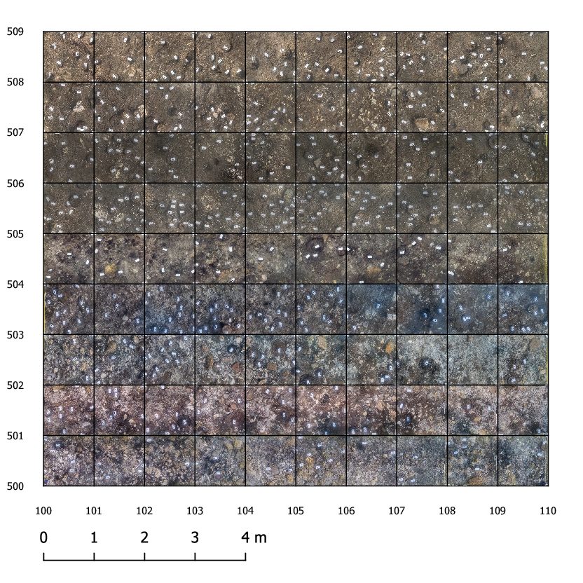
(Fig. 3) The resulting map will be used for the analysis of patterns in the spatial distribution of the piles concerning their age, size or wood species. This will lead to answers regarding architecture, internal chronology and in-site settlement dynamics.
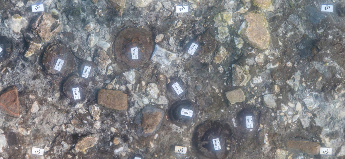
(Fig. 4) On 6 additional square meters, we opened a small trench to obtain stratified archaeological artifacts in combination with bioarchaeological samples. The complete trench was documented 3-dimensional including the surrounding profiles yielding stratigraphic information.
This method is highly promising for the underwater documentation of prehistoric pile-fields, yielding detailed digital plans in an efficient, accurate and inexpensive way. Under the given conditions this workflow has proven its qualities.
(Fig. 5) An in-depth article on this new approach for pile-field-documentation is in preparation. A preliminary version is available as a poster under the following link: https://doi.org/10.5281/zenodo.2552068
Johannes REICH & Marco HOSTETTLER, Bern